|
| *****SWAAG_ID***** | 177 |
| Date Entered | 22/04/2011 |
| Updated on | 12/06/2011 |
| Recorded by | Tim Laurie |
| Category | Geological Record |
| Record Type | Geological HER |
| Site Access | Public Access Land |
| Record Date | 20/04/2011 |
| Location | Muker CP. Birkdale Common. Little Sleddale. Upper Falls |
| Civil Parish | Muker |
| Brit. National Grid | NY 83040 01868 |
| Altitude | 420m |
| Geology | Little Sleddale Beck. Faulted Namurian strata with coal seam above the Crow Limestone exposed in ravine below Upper Falls. |
| Record Name | Little Sleddale Beck |
| Image 1 ID | 583 Click image to enlarge |
| Image 1 Description | Little Sleddale Beck. Upper Falls. | 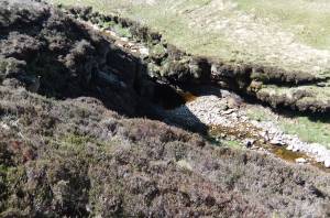 |
| Image 2 ID | 584 Click image to enlarge |
| Image 2 Description | Little Sleddale Beck. Ravine below Upper falls. | 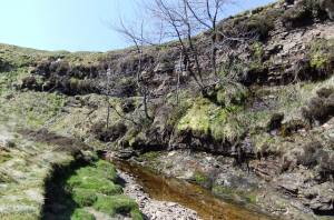 |
| Image 3 ID | 585 Click image to enlarge |
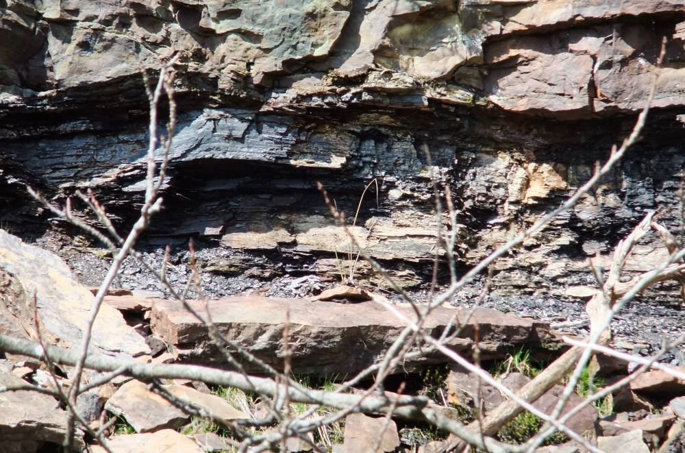
| Image 3 Description | Little Sleddale Beck. Ravine below Upper falls. Coal seam. | 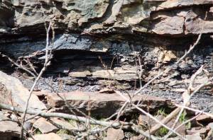 |
| Image 4 ID | 586 Click image to enlarge |
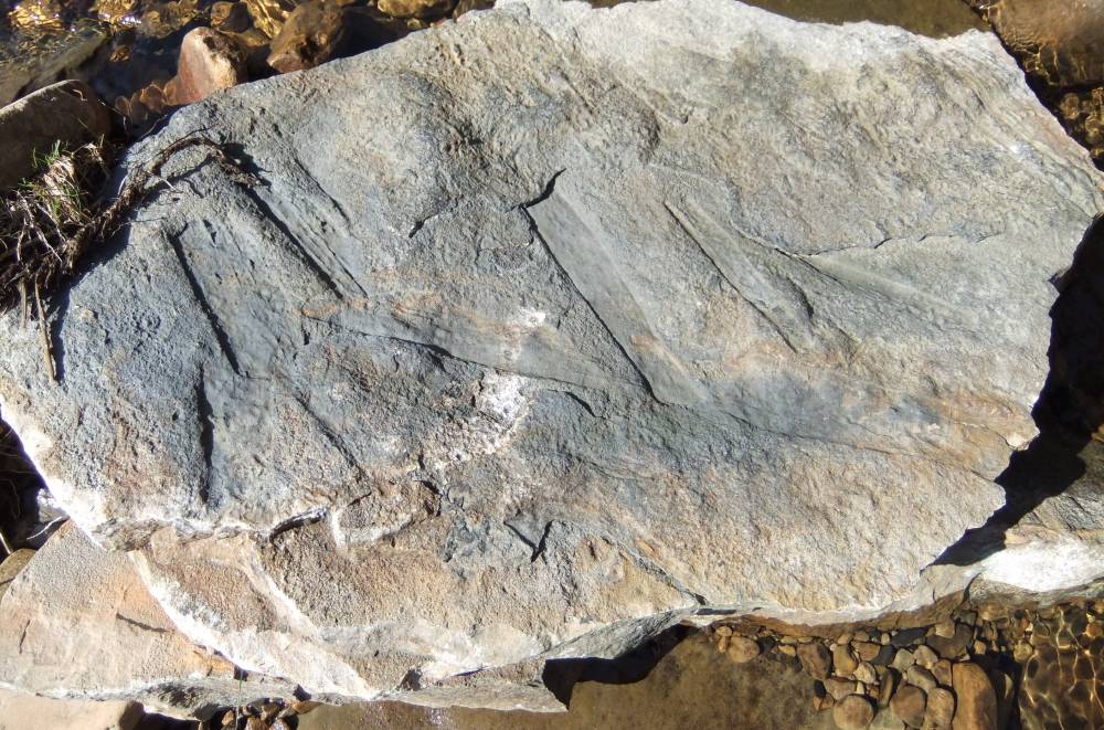
| Image 4 Description | Little Sleddale Beck. Sandstone slab in Beck with plant remains. | 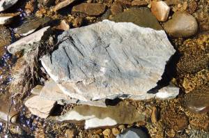 |
| Image 5 ID | 587 Click image to enlarge |
| Image 5 Description | Little Sleddale Beck. Sandstone slab in Beck with plant remains. |  |